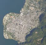
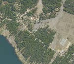
Satellite Images of Atitlan
These aerial photographs were taken in the months after Hurricane Stan in 2005. These are courtesy of CONRED (Coordinadora Nacional para la Reduccion de Desastres)
Click on the pictures for a full page photo
SantiagoAround the Lake Satellite Photos Town Panabaj Atitlán Today History Weaving Art Mayan Religion Social Projects Local Business Tienda Santiago Links Photo Archive 2005 Disaster Music Festival Virtual Maximon